Major flooding in parts of Queensland is the worst in 20 years, with heavy rain set to continue across the state on Saturday.
There are 17 flood watch warnings in place, including for the upper Brisbane catchment area which has already experienced heavy rainfalls in the past few days. The Brisbane River at Gregor Creek is currently at 10.24 metres, above the 7.50 major flooding mark, and rising.
Widespread rainfall totals of between 50 and 140 mm were recorded across the upper Brisbane River catchment in the 24 hours to 9am on Friday. Since then, further rainfall totals between 20 and 280 mm have been recorded.
The Bureau of Meteorology warned on Saturday morning that very dangerous thunderstorms were detected on the weather radar near Noosa Heads and the area north of the area. A severe thunderstorm warning remains in place for the Southeast Coast and parts of Wide Bay and Burnett and Darling Downs and Granite Belt.
The wet weather has been caused by a trough over southeast Queensland which is forecast to deepen into a low over the Wide Bay and Burnett areas. This trough is expected to travel south over the Southeast Coast and into northeastern NSW on Sunday, producing more heavy rain and thunderstorms.
SEQWater had ordered the release of water from Somerset and North Pine dams and was planning the same for Wivenhoe Dam – which normally protects the city from floods – late on Friday night.

The federal government is providing two Defence helicopters to assist Queensland, Defence Minister Peter Dutton said.Credit:Alex Ellinghausen
Defence Minister Peter Dutton said he had authorised the Australian Defence Force to provide support to Queensland Police to assist with air evacuations from flood affected areas.
“Two helicopters have been tasked from Amberley and will join the effort,” he said in a tweet. “It is a dangerous situation unfolding, please take care on our roads.“
The downpour across the south-east was expected to continue over the weekend, but QFES Superintendent James Haig told ABC Radio the weather bureau was unsure when it would end.
More than a thousand calls for help were made on Friday, while State Disaster Co-ordinator Deputy Commissioner Steve Gollschewski said a rescue chopper had been tasked to help a group of people stranded on roofs in the Lockyer Valley.
Severe weather was making rescue chopper flights difficult, while some commercial flights were also delayed.
Earlier on Friday, RACQ LifeFlight rescued five people and their dog, after their property became surrounded by flooding in the Gympie area. The home was cut off in both directions, and the family was forced to drive to a safer spot up a hill near the house, where the helicopter rescued them.
The intense rain was forecast to continue over parts of south-east Queensland on Friday night, through to Saturday and Sunday, tending mainly towards coastal areas from Saturday onwards.

Noosa flash flooding due to intense rainfall in south-east Queensland.Credit:Noosa Council, Facebook
Six-hourly rainfall totals between 80 and 120 millimetres were likely, reaching up to 180 millimetres over areas east of Gympie to Jimboomba.
Emergency Services Minister Mark Ryan said the situation had reached the point where firefighters and SES volunteers would need to go house to house checking on the welfare of residents.
“We have seen water rescue incidents at a long list of locations including Dallarnil, Rocksberg, Tara, Wallaville, Cooroy, Anamoor Creek, Kagaru, Helidon, North Arm, Cooran and Esk to name a few.”
In the past 24 hours, the SES received 956 calls for help and the QFES swift water rescue teams had responded to 41 situations — these included stranded people as well as checking flooded cars.

There are several road closures as a result of flooding, including Upper Coomera Road at the Scenic Rim, where a temporary side track has been washed away.Credit:Scenic Rim Regional Council Disaster Management
Several emergency alerts were issued in the Gympie, Moreton Bay, North Burnett, Noosa, Imbil, Toowoomba, Lockyer Valley and Cedar Pocket regions.
Hundreds of roads were closed across the state, Transport Minister Mark Bailey said.
“We’ve closed a 4.5-kilometre stretch of the Bruce Highway southbound at Caboolture due to flooding, and it’s expected to stay closed for 24 hours,” he said.
Mr Gollschewski said they planned to deal with rivers flooding, particularly the Mary River and inundated homes in Gympie as well as keeping an eye on Maryborough.
“We have multiple road closures … Currently, the township of Goomeri is inaccessible. We expect more of this to happen as the day unfolds.”
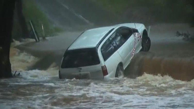
Motorists were urged to stay off the roads during the “life-threatening event”, which has already taken the lives of two Queenslanders this week.
Most Viewed in National
From our partners
Source: Read Full Article